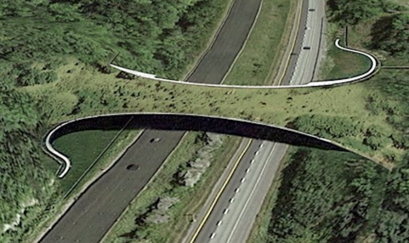
Non-profit conservation organization Appalachian Corridor presented its proposed “Highway 10 Ecological Connectivity Plan” at a press conference on Sept. 12.
The idea behind the plan is to encourage infrastructures that will improve wildlife crossings and restore ecological connectivity between Granby and Mont-Orford.
Now that the group has presented its plan, it will move forward in reaching out to government officials to have it implemented.
Appalachian Corridor also announced that the walking trails on Mount Foster are officially open to the public after a ten year process and the group invites everyone to explore.
“For many years, we have been doing science, studies, and groundbreaking work to identify the specific areas where we should improve the connectivity on both sides of Highway 10 so that wildlife can move freely throughout the area,” explained Melanie Lelièvre, director of Appalachian Corridor. “Reducing wildlife collisions on Highway 10 makes it easier for wildlife to adapt to climate change.”
Lelièvre noted that between Granby and Magog, there are hundreds of wildlife collisions each year, a problem that the group plans to address through its “Highway 10 Ecological Connectivity Plan” by redirecting wildlife away from the highway.
“It’s really based on emerging science that we call “Road Ecology.” (…) What we are suggesting is that in seven precise areas, we improve the permeability of Highway 10 by implementing measures,” explained Lelièvre. “Let’s say from oversized culverts, to crossing structures, bridges, tunnels, a wooden frame so that wildlife can use them as well, mixed with fencing along this portion of the highway.”
The group is suggesting four passages for large wildlife and seven structures for small and medium sized mammals. The focus area is known as the Green Mountains.
“If we take a step back and look at the overall large natural area, the natural province in which we are, it’s the Northern Appalachians. This region is rich in biodiversity and plays an important role to enable the connectivity at the North American scale,” said Lelièvre. “(…) Within this large area, the Green Mountains have been identified as one of the critical links for connectivity.”
Lelièvre explained that wildlife always needs to move freely throughout an area to mate, to have new territory, to eat, to have water, but with climate change there is an extra stress put on wildlife.
She added that close to $150 million has been invested in protecting areas on private land in the Green Mountains over the last 25 years and that the Highway 10 Ecological Connectivity Plan” will further ensure the success of those investments.
“This project would be a way to ensure those previous investments because isolated protected areas, overtime, it’s not enough. We know that if they’re not connected, the biodiversity, the functionality of the ecosystem, decreases overtime,” explained Lelièvre.
With the plan now completed, Appalachian Corridor will be reaching out to top government officials to work together to have it implemented.
“We are the moment where we are asking such a vision to be accepted by the highest level of government, like the next Prime Minister of Quebec, and that the leadership should be taken by the Ministry of Transportation in collaboration with Ministry of Environment and the Ministry of Wildlife,” said Lelièvre.
Apart from its new plan, Appalachian Corridor announced that the trails to access Mount Foster have been officially opened up to the public after 10 years of working on the project.
“It permits the access to the summit of Mont Foster of what was used to be called the Scout Tower. There’s a nice tower, a 10 meter tower, with a stunning view of all the Green Mountains,” noted Lelièvre.
Lelièvre emphasized that Appalachian Corridor is always looking for people to get involved or to volunteer to continue to carry out its work in the community. She invites the public to check out the group’s website and to reach out for more information.
Listen to the full interview below:


