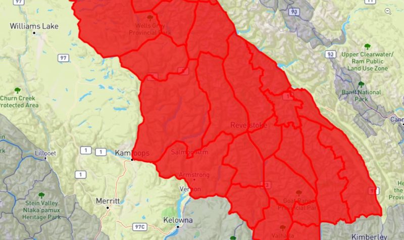
Avalanche Canada released a special public avalanche warning on Dec. 28 until Jan. 2 for a large swath of the interior of B.C., including the Revelstoke region.
"We have a large amount of storm snow sitting on an unusually weak lower snowpack, meaning we could see large avalanches, even as the avalanche forecasts trend to lower danger ratings." Said a spokesperson with Avalanche Canada in Revelstoke, by email.
The warning region includes most of the Columbia Mountains, Glacier and Mt. Revelstoke National Parks, extending south to the Purcell Wilderness Conservancy and Kokanee and Valhalla Provincial Parks, extending north to the Northern Rockies, Williston Lake north of Pine Pass and Mackenzie.
Special public avalanche warnings are issued when forecasters think conditions are dangerous and there is something unusual about the snowpack, rather than straightforward high danger such as after a storm, the spokesperson wrote.
People going into the backcountry can mitigate the risk of triggering avalanches by sticking to lower angle slopes and choosing smaller objectives.
Avalanche Canada says danger ratings may go down as the weather improves, but there will still be a chance of triggering large avalanches.
CLICK THE LINK BELOW TO LISTEN TO A RADIO REPORT


