
By Roy L Hales
While the largest local landslide occurred only months ago, local historian Judith Williams says Bute Inlet ‘lets loose’ all the time.
The earliest information she has comes from the diary Robert Humphrey left, after he came to survey the area in 1861.
“He describes, very elaborately, an avalanche coming down the Homathko side carrying stands of trees,” explained Williams. “So it’s nothing new, this is an area that lets loose all the time.”
One of the better known slides disrupted plans for a Halloween party during the 1970s. The residents of a logging camp, on the flank of the inlet, abruptly left after “everything moved.”
Williams says landslides leave lots of scars on the landscape and “every so often you go up and there is a new one.”
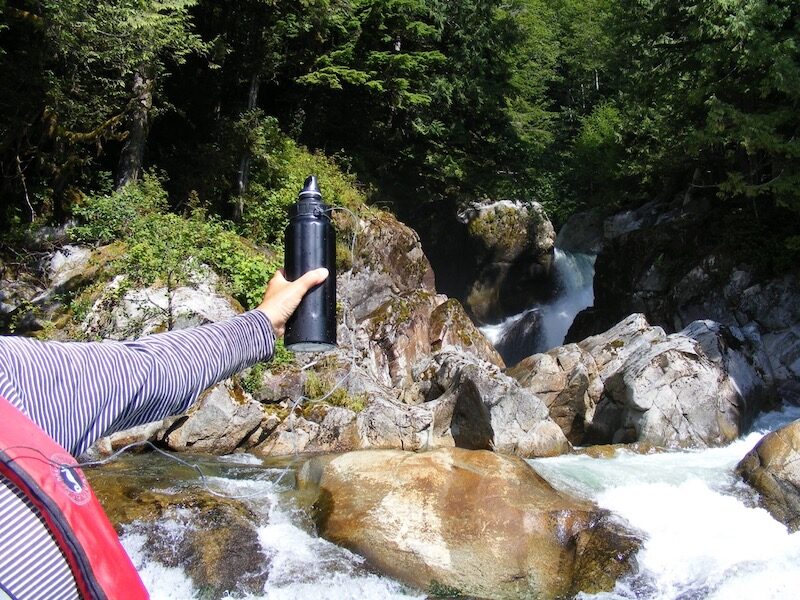
Collecting water at the Paradise River in 2011 at Bute Inlet. Photo courtesy of Judith Williams.
The most recent Bute Inlet slide
She finds the most recent slide especially interesting because of the possible link to Climate Change. The Homathko Icefield is shrinking and part of the glacier fell into Elliot Lake. A 100 ft. high tidal wave crashed down Elliot Creek, into the Southgate River and into Bute Inlet.
Williams suspects that some of the debris reached Cortes and Quadra Islands. She saw “a fair bit of wood in the water,” while crossing over on the ferry.
“I was seeing things that looked kind of raw. The top was broken and shattered. The roots were broken. They hadn’t been bouncing around on the shore for a long time, where things get smoothed around,” she explained. “If you see a log like that, you know it has been washed out from somewhere.”
Williams has a special connection to Bute Inlet.
“I’ve spent a lot of time: I’ve written two books centered on Bute. So I take a big interest and I’ve also travelled up there a number of times and even stayed up in the logging camp. So I feel very attached to it,” she explained.

Some of the water samples. Photo courtesy of Judith Williams.
Water collecting project
Williams started collecting water, from the eighteen rivers that empty into Bute Inlet, when there were plans to put run of river hydro projects into the area. The land is too steep to accommodate the 400 ft. wide corridors that power lines need.
“Putting in any kind of apparatus for carrying power will lead to more and more avalanches," she said.
If the power project had gone forward, Williams would have taken more samples to see what had changed.
As a result, she has a water sample from Elliot Creek prior to the landslide and will soon be in possession of a current sample.
“We think we have lots of water because it rains all the time, but the big storages are in the glaciers. If we tamper with these, and climate is already tampering, we could find ourselves in an odd position. You can read articles and watch programs, these days, about how water is going to be the new oil, it is in such demand. We have it, we should look after it.”
Links of interest:
- (Cortes Currents) articles about the most recent Bute Inlet landslide
- (Cortes Currents) Judith Williams new Book (Cougar Companions: Bute Inlet Country and the Legendary Schnarrs)
- Judith Williams website
- (Cortes Currents) articles about, or mentioning, Judith Williams
- (Cortes Currents) articles about or mentioning Bute Inlet