
On Sunday, October 8, 2023 at approximately 4:00 PM, roughly 15 kilometres South East of Chetwynd BC, a wildfire was discovered on the iconic plateau topped mountain visible from town. The town is located along the Pine Pass section of Highway 97 in the province’s Peace Country region.
Now named the Mount Wartenbe fire, it was determined to be caused by a lightning strike during an electrical storm.
The fire is currently covers 1,246 hectares. Over two dozen properties in the area have been issued an evacuation alert by the Peace River Regional district. At this time the townsite of Chetwynd has not been issued an alert. The alert includes properties near Highway 97 (West of Chetwynd Pulp Mill Rd and East of Guillet Sub) and certain properties on Rimsmith Rd. Residents there are advised to be prepared to leave on short notice.
In an interview with CFUR, Sharon Nickel, a Fire Information Officer of the BC Wildfire Service’s Prince George Fire Centre, details the nature of this fire, its risks, and describes its terrain. Nickel mentions that this is one of twenty four Wildfires of Note (a wildfire that is highly visible or poses a threat to public safety) since April 2023 in the Prince George Fire Centre, and one of six hundred sixty nine in the Fire Centre overall.
One of the causal factors is the regional drought experienced since last fall of 2022. Nickel explains, “When we’re looking at those drought conditions combined with the gusty winds that are typical for the Peace Region this time of year, which also aid in drying out the ground and fuel, there’s a good possibility of fire growth despite what the calendar says.”
She reminds us that the public is the Wildfire Service’s greatest resource in reporting wildfires, saying “Forty percent of fires spotted are called in by the public.”
To report a wildfire call *5555 from a mobile phone, 1-800-663-5555 from landlines; you can use the BC Wildfire App; email either infopg@gov.bc.ca or hcr.1800@gov.bc.ca.
Be prepared to describe with the best of your ability, the approximate size of the fire, type of fuel present, the colour of smoke, and location. The more information the better.
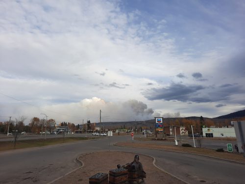
Smoke from the Mount Wartenbe Fire, visible from Chetwynd's main drag. Photo Credit - Ian Gregg
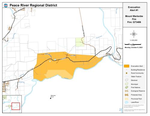
North of the Pine River, and alongside Highway 97, an evacuation alert has been issued for about 2 dozen residents. Picture Credit - Peace River Regional District