A glacier is a huge mass of ice that moves slowly over land. Glaciers fall into two groups: alpine glaciers and ice sheets.
Alpine glaciers form on mountainsides and move downward through valleys. Sometimes, alpine glaciers create or deepen valleys by pushing dirt, soil, and other materials out of their way. Alpine glaciers are found in high mountains of every continent except Australia (although there are many in New Zealand).
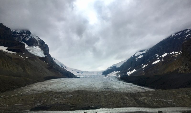
BC has about 17,000 glaciers and Alberta has around 800. Glaciers cover 3% of BC's land mass. Between 1985 and 1999, the annual amount of water lost from melting glaciers in BC was 22 cubic kilometres. Close to 90% of BC's energy is hydroelectric, and melting snow and ice play a significant role.
Tracking these glaciers and their mass has, for decades, been an arduous task for geologists. Scientists would track glacial change by measuring individual glaciers and comparing their size over time with records of the local and regional climate which often involved sending teams to conduct the measurements and hiring aerial photographers to map the glacier.
A University of Northern British Columbia PhD student has helped change the way glacial shrinkage is documented in British Columbia and Alberta.
Listen below to Pamela's interview with Alex from the Department of Geography, Earth and Environmental Sciences, University of Northern British Columbia, Prince George.