
Most of the 64 active COVID-19 cases in North Vancouver Island are probably in Greater Campbell River or the Comox Valley.
These were the only Local Health Areas where the virus was reported in the BC Centre for Disease Control’s latest geographic distribution map, which was released last night. A total of 53 cases were reported for the epi-week ending on Saturday, Aug. 28. 23 of these were in the Greater Campbell River Health Area, which includes Sayward, Buttle Lake, Oyster River, the Discovery Islands and the city of Campbell River.
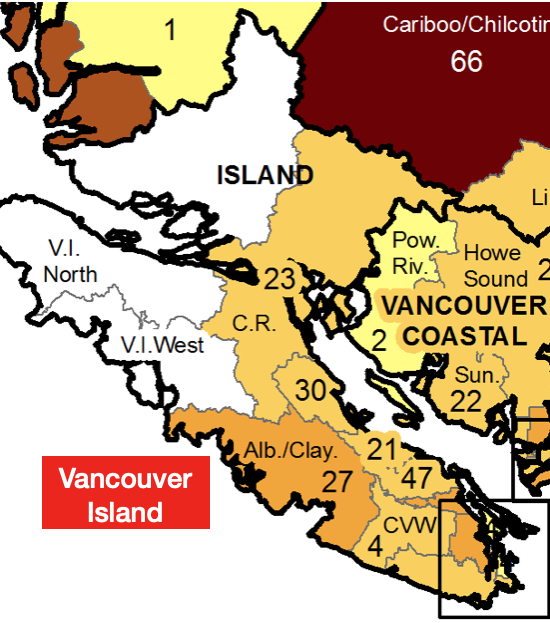
Adapted from the Geographic Distribution Map of COVID-18 cases on Vancouver Island. Map courtesy of the BC Centre for Disease Control.
The average rate of new cases reported daily in Greater Campbell River, was 1 per 10,000 people.
Though there were more cases in the Comox Valley Local Health Area, the daily rate was only two thirds as high (6 per 100,000).
These were all cases of the Delta variant.
Unlike the previous waves of COVID-19, the highest rates of infection are in people between the ages of 15 and 39.
The rate is much lower among seniors aged 70 and over, 92 per cent of which are now fully vaccinated.
As of Sept. 13, you must have proof of vaccination to go to a restaurant, an indoor meeting, wedding or party.
This restriction does not apply to voting in person during the 2021 election.
All BC residents attending public gatherings after Oct. 24 will need to be fully vaccinated.