
Nearly 100 people provided their thoughts and guidance into the new Cortes Island Evacuation Plan, updated for late 2021.
Strathcona Regional District Protective Services Coordinator Shaun Koopman was in charge of the project. Koopman has been in this role for almost six years, and when asked whether that experience gives him a good sense of the normal ebbs and flows of adverse weather mitigation, he responded, “nothing is normal anymore.”
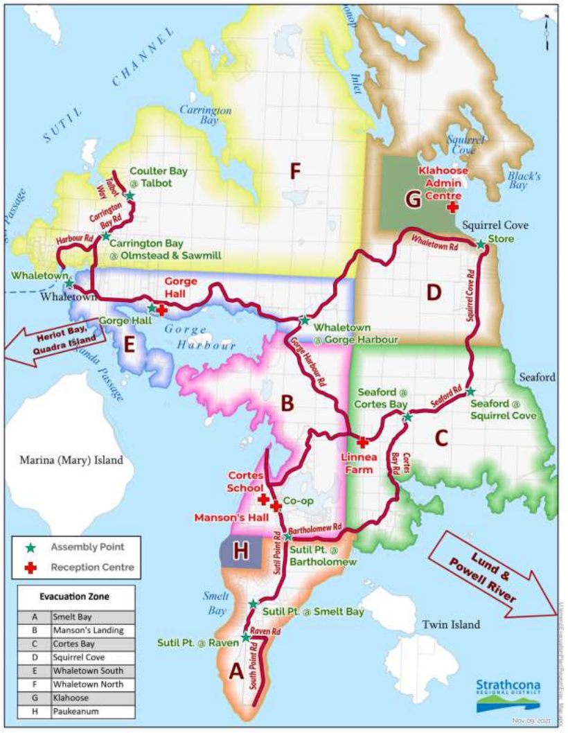
The map of evacuation zones was one of the few pieces kept from the old version of the plan. Image courtesy of Strathcona Regional District.
For this reason, he urges people to get informed and prepared well ahead of any potential disaster situation. Although the 161-page PDF is a lengthy document, Koopman would like everyone to know the procedures for if, and when, emergency situations arise, be it floods, wildfires or earthquakes.
The evacuation plan outlines several scenarios with varying responses based on the emergency at hand. Koopman suggests having several different ready-to-grab bags of provisions for different situations. He said he personally has three separate kits: one for evacuation, one for sheltering-in-place and one for being of assistance in earthquakes.
In an emergency situation, various channels of alerts would be triggered, from radio to social media, to door-to-door notifications by the RCMP and Coast Guard. Residents can sign up for notifications online via the Connect Rocket.
Listen to the CKTZ News update below: