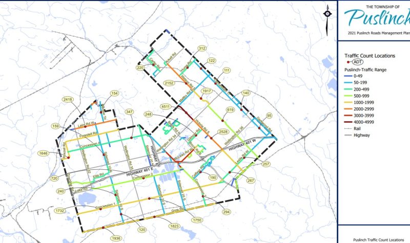
Puslinch council had a report that examined local roadways in front of them yesterday and it sparked much conversation.
Coun. Sara Bailey felt that it's never been fully laid out what the distinct purpose of many local roadways are in the township.
"I'm struggling with the fact that we haven't identified the actual function of our township roads. Nobody has said out loud 'this is not for livability, this is not for recreation, this is just for the movement of cars,'" Bailey said.
Using Maltby Road, a local road, as an example, Bailey brought up the issue of not knowing what to tell patrons asking about its purpose.
In response to Bailey, Director of Public Works Mike Fowler tabled the fact that due to its location, the township should be viewed through an altered lens in terms of roadways.
"The infrastructure is still a rural platform infrastructure, where we offer half-metre shoulders. It is not the most ideal for walking. If I was to call what our road system would be, it would be a commuter network," Fowler explained.
"We are the victims of being in close proximity to the 401 highway with three major urban centres to our North, West and South and we are kind of caught in the middle," he said.
Bailey was the one who urged the township to do exactly that: say out loud what their designation would be.
Fowler said frequent closures of the 401 only add to the commuter network Puslinch has become.
The issue will be circled back to in September when a revised draft is before council.
Listen to the CICW story below:


