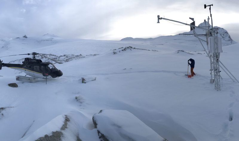
Big, scaffolding weather stations are scattered through the wild back end of the Upper Columbia Basin. Throughout the winter Justin Finn goes by helicopter to maintain the stations, and monitor the snow. Usually by this time of year he sees the snow melting.
Slow spring melts are part of a natural cycle, he says, "but it does set us up for increased flood risk potential."
BC Hydro contracts the company Finn works for—-Northwest Hydraulic Consulting, to provide this raw data on the snowpack.
The BC River Forecast Centre also interprets the numbers provided by Finn in snow survey and water supply forecasts.
The most recent forecast was released on May 15. It showed that the snowpack in the Upper Columbia on May 1 was on average 21 per cent higher than prior May firsts.
Dave Campbell, the head of the BC River Forecast Centre, based in Victoria, says he sees this level of snowpack, this time of year, maybe once every five or ten years.
"It’s unusual, [but] it’s not unprecedented."
If the weather continues to be cool throughout the entire summer, or even if its seasonable, then Campbell says it’s likely that the river and creek levels will be high, and that’s it.

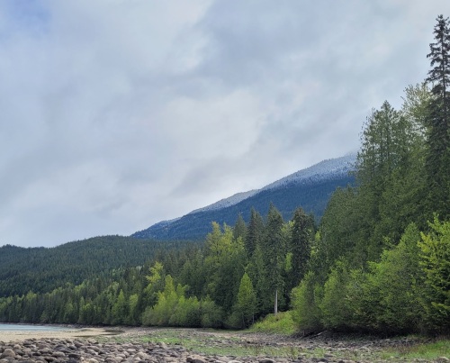
After a day of rain in the Columbia River valley in Revelstoke, the clouds part to reveal fresh snow low in the hills. Photo by Meagan Deuling.
However, a wave of extreme heat, or unusually heavy rain in the coming weeks, could expedite the melt and lead to landslides and floods.
The risk isn’t to the Columbia River, part of the reason it's dammed so heavily is to manage floods, but to smaller creeks that you normally wouldn’t look at twice. Water can surge through them in the blink of an eye, washing out highways and train tracks.
Bob Melnyk maintained the highways around Revelstoke for 18 years, between 1974 and 1992. He knows the road so well he could drive it with his eyes closed, he said.
There's a small creek west of Victor Lake coming off the mountain side that he says to "watch like a hawk."
“Last year I believe was it was one of the biggest debris flow that I’ve seen for a long long time,” Melnyk said.
Debris flow means that water is scouring soil and trees from slopes, and it could lead to build up, damming, and sudden bursts.
There are other things Melnyk says to look out for while on the highway.
If you pass a creek channel that you know should have running water this time of year, and it's dry, or if it's usually clear but running murky, "you should pay attention, and don't stop."
A dry creek bed, or murky water, could mean a log jam or debris is impeding the water flow further up the slope, and it can burst suddenly and take out the bridge or road.
Everyone has cell phones these days, Melnyk says. If you see a creek with a lot of debris, or a dry creek bed, he says to report it to the department of highways.
Finn says, best case scenario, this cool, wet spring will mean a lush green summer without forest fires.
Listen to the Stoke FM story below:


